About Kakadvitta
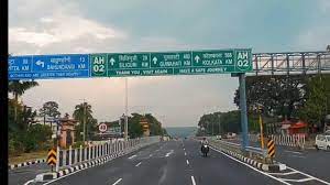
Kakarvitta is a small city situated mechinagar municipality, jhapa district, Nepal. In boarder of Nepal and India. Kakarvitta is on the Nepal-India border at t he eastern end of the 922-km long East-West Highway. It is a 610-km drive (13 hrs.) from here to Kathmandu. The Mechi river bridge marks the boundary between Nepal and India. On the Indian side, Gangtok the capital of Sikkim is 14km (a four-hour drive) and Darjeeling is 113km (three hours).
The meaning of kakarvitta is land of crabs. kakar= crab, vitta=land. On a clear day you can see the foothills of the Kanchenjunga range; from the plains. The way up to 2500 meters is Nepal's tea growing area. You can Notice the well-practiced intercropping method the local farmer's use. No vast plains of wheat here, but potatoes in with corn, spinach in with spices etc. Walking these roads you really see how modern Nepal lives alongside ancient Nepal. The Satighata tea estate is just ten minutes' walk south of town, and a Buddhist monastery run by Tamangs can be visited on the way. A walk along the banks of the Mechi River, just east of town, is nice at sunset or sunrise. Kakarvitta marks the eastern end of Mechinagar Municipality.